

Beinn a' Bhathaich Ard [Beinn a' Bha' ach Ard]
Good walks are even better shared.
Overview
Beinn a' Bhathaich Ard
Overview
Nestled within the stunning Scottish Highlands, Beinn a' Bhathaich Ard stands proudly at 919 meters. Known as a Munro, it offers breathtaking vistas that make for a rewarding hike.
Geology
The mountain is primarily made up of granite, which gives it a robust character, surrounded by the gentle undulation of other hills and the sweeping valleys. Glacial activity has carved both shape and beauty into this terrain, which is a feast for anyone interested in earth sciences or simply in need of a good Instagram backdrop.
Routes
Two main routes are favoured by hikers:
- Main Path from Corrie: This moderate route of 8.5 km traverses scenic landscapes and is well-marked. It generally takes around five hours to conquer.
- Radical Ridge Route: For the adventurer at heart, this challenging route covers about 10 km. Expect a six-hour journey that rewards you with jaw-dropping ridge views and a sense of triumph.
Summit Features
At the summit, you will find a robust stone cairn. It’s a great place to catch your breath—literally and metaphorically—and take in the scenery. Just be sure to leave your own rock as a signal to future wanderers!
Terrain
The hike features a varied terrain of grassy slopes interspersed with rocky outcrops that may keep you on your toes. Expect a bit of playfulness underfoot!
Views
Once you reach the summit, prepare to behold sweeping panoramas of glens and peaks stretching into the horizon. Notable sites include Loch Ness, tantalisingly far yet alluring like a distant promise of adventure. The best views are generally during late spring and early autumn, though winter can also provide stunning snowy vistas.
Hazards
As with all mountainous regions, hazards are present, including steep sections that can become treacherous when wet. The weather is known to change on a whim here, so make sure you're prepared for all eventualities—nature certainly enjoys a laugh!
Nearby Summits
Beinn a' Bhathaich Beag is a friendly neighbour worth exploring as well. It’s shorter but still charming, offering a great addition to your hiking itinerary.
Access
The nearest parking area, located at the Corrie car park, provides free parking, making it a convenient starting point. Should you prefer public transport, buses operate from Inverness, though having a car affords more flexibility.
Facilities
While there are no facilities directly on the mountain, small villages dotting the area offer ample cafes and toilets to fuel up before your adventure.
History
Believed to derive its name from Gaelic meaning 'Hill of the Upper Battlefield', Beinn a' Bhathaich Ard has historical significance tied to ancient skirmishes. It serves as a reminder of the storied past uniquely woven into the fabric of this marvellous landscape.
Conclusion
For those looking to both challenge themselves and immerse in the beauty of the Scottish Highlands, Beinn a' Bhathaich Ard offers an unforgettable experience. With right equipment, a bit of humour, and a penchant for the outdoors, you're set for an epic journey. Just remember, as with all great adventures, leave no trace and take nothing but memories (and maybe a wee bit of chocolate).
Explore routes near Beinn a' Bhathaich Ard [Beinn a' Bha' ach Ard]
Public walks starting within 80 km of this hill. Nearby does not mean a route reaches the summit; check its map and access before setting out.
Glen Affric: Coire Loch Woodland Trail
View route
Loch Affric full circuit from River Affric
View route
Inverness: River Ness and Caledonian Canal circuit
View route
Great Glen Way low route: Fort Augustus to Invermoriston Old Bridge
View route
Route planning notes
These notes describe possible approaches, not verified navigable routes or permission to cross land. Check current paths, local access rules and conditions before setting out.
Main Path from Corrie
A well-defined and popular route starting from Corrie, offering fantastic views along the ascent.
Radical Ridge Route
A more adventurous route that follows along the ridge line, suitable for those looking for a bit of a challenge.
Make a day of it, together
Find someone to share the walk with, or organise a day out along a route you like.
Photo Gallery
View all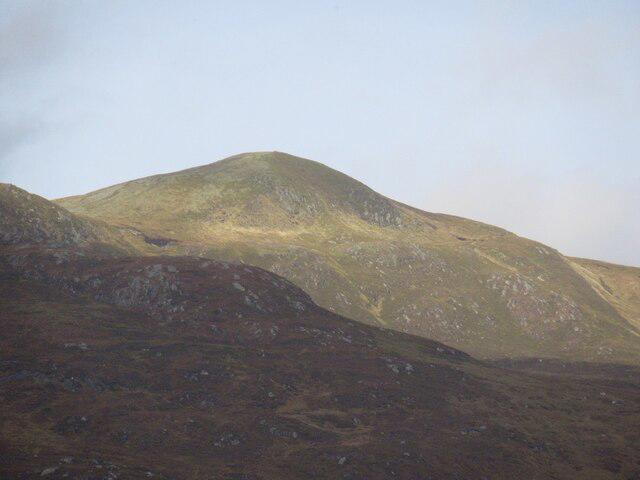 Photo could not load
NH3643 : Beinn a' Bhàthaich Àrd
Richard Webb
 Photo could not load
NH3643 : Beinn a' Bha'ach Ard
Nick Ray
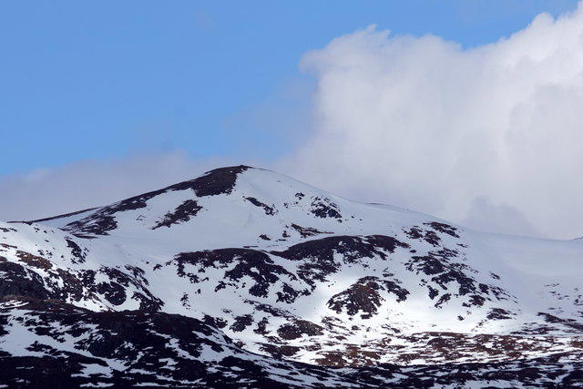 Photo could not load
NH3643 : The summit of Beinn A' Bhathaich Ard from Struy
Mike Pennington
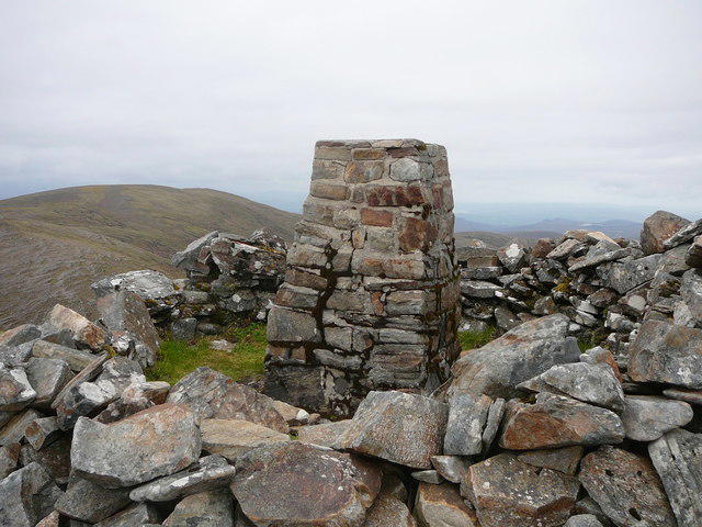 Photo could not load
NH3643 : Trig Point on Beinn a' Bha'ach Ard
Colin Park
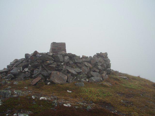 Photo could not load
NH3643 : Summit, Beinn a' Bhalach Ard
Chris Eilbeck
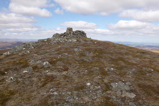 Photo could not load
NH3643 : Summit, Beinn a' Bhàthaich Àrd
Craig Wallace
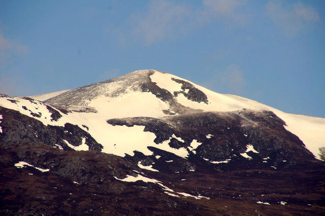 Photo could not load
NH3643 : Summit of Beinn a' Bhathaich Ard
Mike Pennington
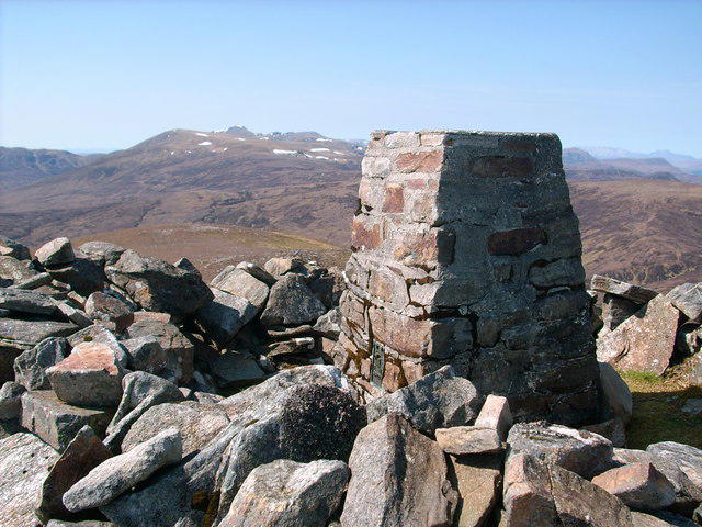 Photo could not load
NH3643 : Beinn a' Bha'ach Ard summit Trig point
Stephen Middlemiss
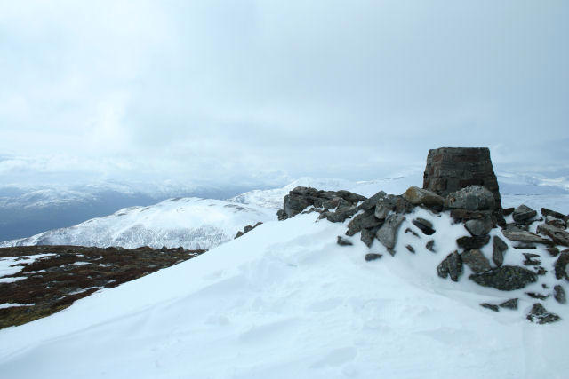 Photo could not load
NH3643 : Beinn a bha'ach ard
David Maclennan
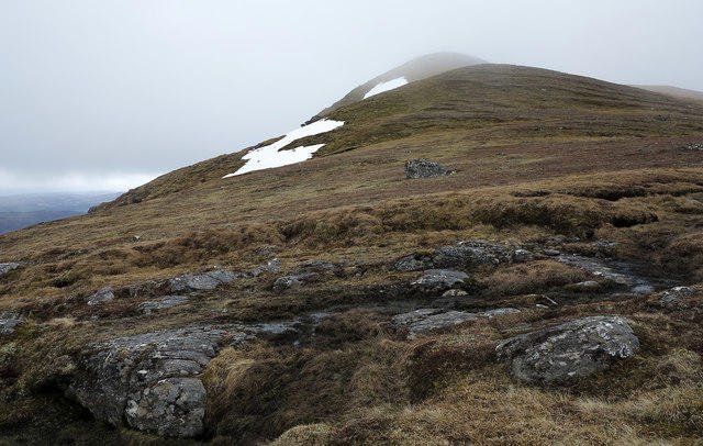
NH3643 : Beinn a' Bhàthaich Àrd
Trevor Littlewood
Hill facts and local notes
Classifications
Elevation
862m
2,828 ft
Prominence
241m
Coordinates
57.4519, -4.7339
NH360434
OS Map
26
Explorer: 431
At the Summit
The summit boasts a prominent cairn, a true testament to the dedication of hillwalkers. On a clear day, the views from this spot will take your breath away – and not just from the altitude!
Terrain & Geology
The summit is primarily composed of granite, which is characteristic of the region. The eroded landforms and glacial features present present a captivating history of the Earth's geological processes.
Views & Scenery
From the summit, you can gaze upon the expansive glens, distant peaks of the Cairngorms and Loch Ness shimmering in the distance. Just mind the 'Nessie' jokes.
History & Heritage
Name Origin
The name translates from Gaelic as 'Hill of the Upper Battlefield', hinting at its storied past.
Historical Significance
Noted in local folklore, Beinn a' Bhathaich Ard is said to be a site of ancient battles and sagas, making it a remarkable site for both history enthusiasts and hikers alike.
Getting There & Facilities
Check current local access restrictions, parking rules and transport timetables before travelling. These notes do not confirm public access to the summit.
Parking
Free parking available at the Corrie car park, accommodating several vehicles. Get there early on weekends!
Public Transport
The nearest bus service operates from Inverness to nearby villages, though a car is recommended for ease of access.
Nearby Facilities
There are no facilities on the mountain, but local villages offer cafes and toilets for pre-hike preparation.
Safety Information
Known Hazards
- Steep sections with loose rock; care should be taken particularly in wet conditions. Weather can change rapidly, so keep an eye on the sky.
General Safety Tips
- Check weather conditions before setting out
- Carry appropriate clothing and equipment
- Let someone know your planned route
- Take a map, compass, and GPS device
- Carry emergency supplies: food, water, first aid kit, torch
Hills
Some common questions about the hills answered
Are there group walks up Beinn a' Bhathaich Ard [Beinn a' Bha' ach Ard]?
Many walkers use Walkmates to join or organise walks with others. You can check for group walks around Beinn a' Bhathaich Ard [Beinn a' Bha' ach Ard] through the maps
Are there other walkers around Beinn a' Bhathaich Ard [Beinn a' Bha' ach Ard]?
Activity varies by location and time, but Walkmates lets you see whether others have shared walks or shown interest in this area. Find other people through the walking friends search walking friends for Beinn a' Bhathaich Ard [Beinn a' Bha' ach Ard] search or of course create your own walk for Beinn a' Bhathaich Ard [Beinn a' Bha' ach Ard]
Can I organise a walk to Beinn a' Bhathaich Ard [Beinn a' Bha' ach Ard]?
Yes. If there aren’t any walks listed already, you can create a walk and make it available for others to join.
If you're signed up to Walkmates, you can create a walk to Beinn a' Bhathaich Ard [Beinn a' Bha' ach Ard].
How do I find a walk up this hill?
There are often multiple ways to walk this hill, depending on experience and route preference. Walkmates helps you explore walks and routes that others have shared.
Can I suggest a new route up Beinn a' Bhathaich Ard [Beinn a' Bha' ach Ard]?
Yes. You can suggest or create routes to share with others. Walkmates focuses on the social side of walking, so routes are used to help people organise walks and explore areas together, rather than as detailed navigation tools or route libraries.
Other uses really appreciate knowledgeable walkers sharing their routes. Share your favourite route to Beinn a' Bhathaich Ard [Beinn a' Bha' ach Ard] here
The is an error or something incorrect about this hill. How do I let you know?
We always strive to keep the information on Walkmates as accurate as possible. If you find an error, please let us know through the contact form and we'll aim to correct it as quickly as possible
Community Discussion
Comments
Location
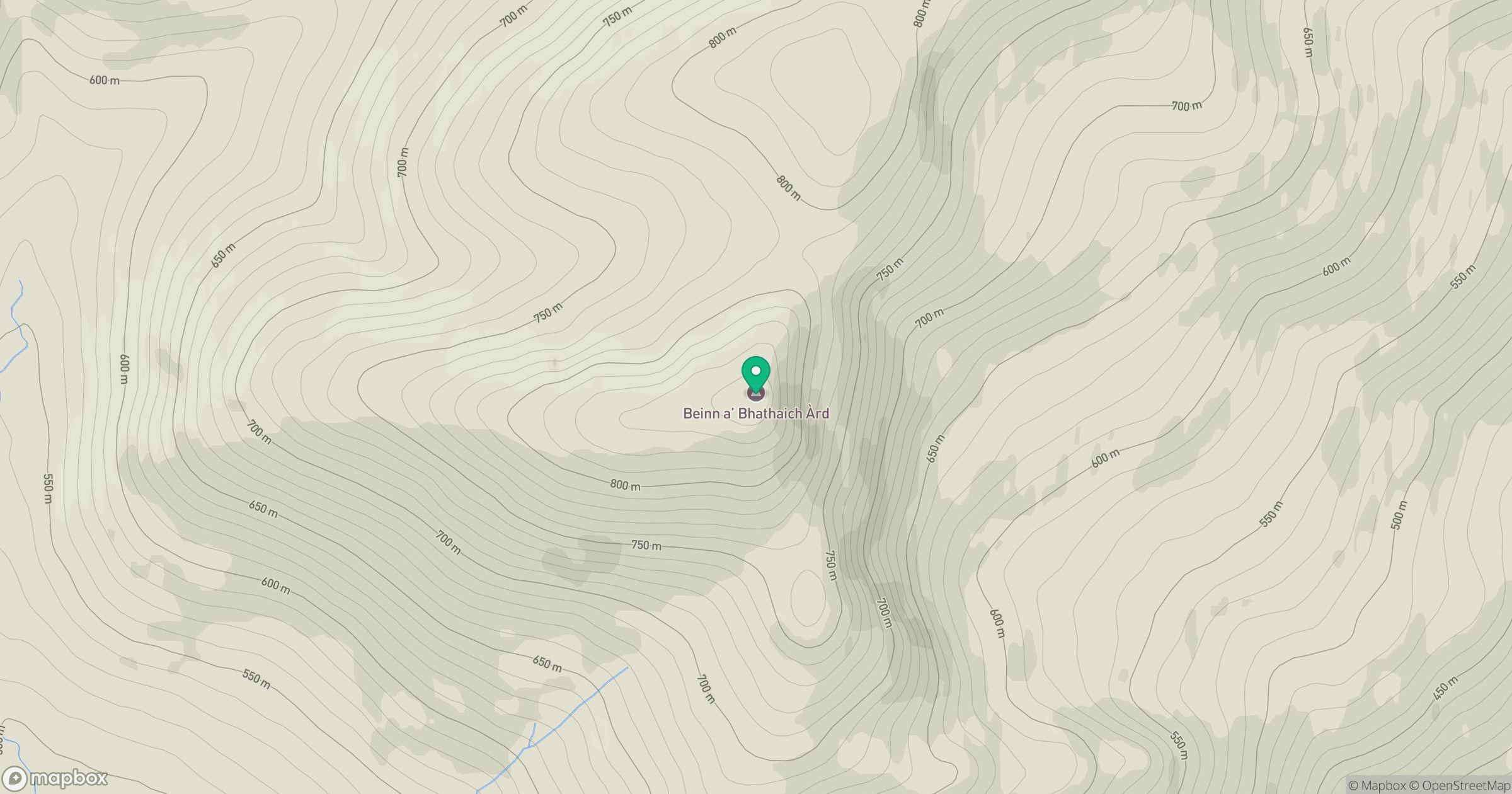
Grid reference: NH360434
View on OpenStreetMapOpens a map in a new tab, centred on the hill.
Hills within 30 km
Straight-line distance, not a walking route or confirmation of access.
No comments yet. Be the first.